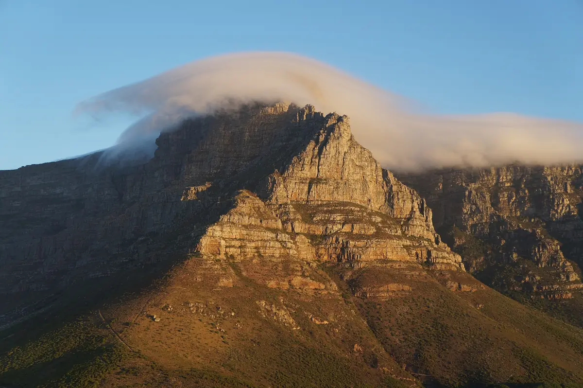
Weather on Table Mountain
Cape Town has a Mediterranean climate: cool, wet winters and warm, dry summers. The mountain adds its own weather on top of that. Wind and cloud can differ completely between the city, the lower slopes and the summit, so a sunny waterfront is no promise of a clear plateau.
The best plan is flexible. Check the cableway status on the morning, keep a spare day and carry a warm layer, even in summer.
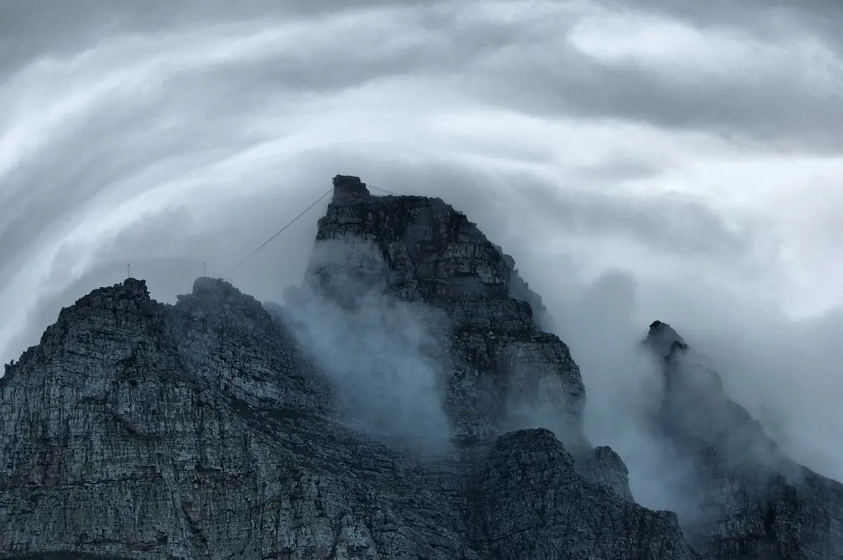
The tablecloth explained
The cloud that spills over the edge.
What it is
The tablecloth is a layer of cloud that flows over the edge of the mountain and down the slopes. It comes with the south-easterly wind, often called the south-easter. It does not happen every day, and you cannot read a clear view from its absence.
Why summer brings wind
In summer, high pressure over the South Atlantic pushes south-easterly winds and moisture against the mountain barrier. That is when the cloud is most likely to build. The strongest south-easters fall in December and February.
Winter fronts
In winter, fronts bring rain. North-westerly winds in winter and southerly winds in summer can reach gale force.
Local differences
Yearly rainfall on the Cape Peninsula runs from about 400 to 2,270 mm, depending on the spot. City or airport figures do not describe the summit.
Table Mountain tours for all kinds of weather
Cableway tickets, city tours and Cape Peninsula day trips, with live prices and availability.
Cableway closures and the weather
The cableway runs when conditions allow.
What can close it
Wind, cloud and maintenance can stop the cableway. Bad weather closures can happen at short notice, including while you are on top.
No fixed rule
There is no single wind or cloud rule you can plan around, and cloud alone does not always shut it. Use the daily status on the operator's website and app, and check again before you set off.
Annual maintenance
The cableway shuts for maintenance once a year. In 2026 the dates were 27 July to 9 August.
Cableway guide →If you hike
The park authority advises against walking to Maclear's Beacon in low cloud or fog, because it is easy to lose your way. If weather stops you moving, stop at a safe, sheltered spot, and turn back in good time.
Hiking guide →Planning around the weather
Simple rules for a flexible visit.
Check twice
Look at the operator's status in the morning and again before you leave for the station. Conditions can change within the hour.
Use the ticket validity
A standard cableway ticket is valid for 7 days. Keep your first days flexible and save the mountain for the clearest one.
Swap the order of your days
On a cloudy or windy day, move to Cape Point, Boulders Beach or the Zeitz MOCAA museum at the V&A Waterfront, and go up the mountain when the sky clears.
Cape Point →Pack for a change
Take waterproof and warm clothing even in summer, plus water and sun protection. Wind and cloud can arrive without much warning.
Know the fire season
The park authority warns of a high to extreme fire risk in the coming season. Rangers close trails when needed, and fire break work along the peninsula is expected to run to December 2026.
Hiking guide →Cape Town temperatures and rain by month
Long-term averages for the city, 1961 to 1990. They are not summit values and not measurements for 2026.
| Month | Average high °C | Average low °C | Rain mm |
|---|---|---|---|
| January | 26.1 | 15.7 | 15 |
| February | 26.5 | 15.6 | 17 |
| March | 25.4 | 14.2 | 20 |
| April | 23.0 | 11.9 | 41 |
| May | 20.3 | 9.4 | 69 |
| June | 18.1 | 7.8 | 93 |
| July | 17.5 | 7.0 | 82 |
| August | 17.8 | 7.5 | 77 |
| September | 19.2 | 8.7 | 40 |
| October | 21.3 | 10.6 | 30 |
| November | 23.5 | 13.2 | 14 |
| December | 24.9 | 14.9 | 17 |
The highs and lows are daily averages, not records. Summer is warmer and usually drier, and a winter visit means planning for rain.
Plan the rest of your visit
Weather decides the order of your days.
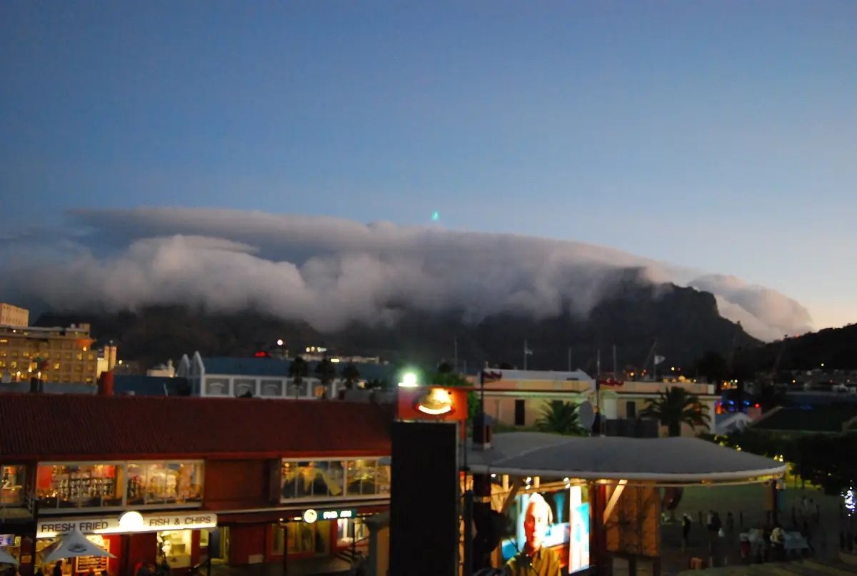
Table Mountain weather: frequently asked questions
What is the tablecloth on Table Mountain?
It is a layer of cloud that flows over the mountain's edge and down the slopes, driven by the south-easterly wind. It does not occur every day.
When is it windiest?
The strongest south-easterly winds are in December and February. Winter north-westerlies and summer southerlies can also reach gale force.
Does cloud close the cableway?
Not always. Wind, cloud and maintenance can all stop it, but there is no single cloud rule. Check the operator's status on the day.
Is the weather on top the same as in the city?
Not necessarily. Wind and cloud can differ completely between the city and the summit. Bring a warm layer even in summer. The monthly table above shows city values only.
Which month is rainiest?
June has the highest long-term average in the table, at 93 mm, followed by July and August. January and November are among the driest.